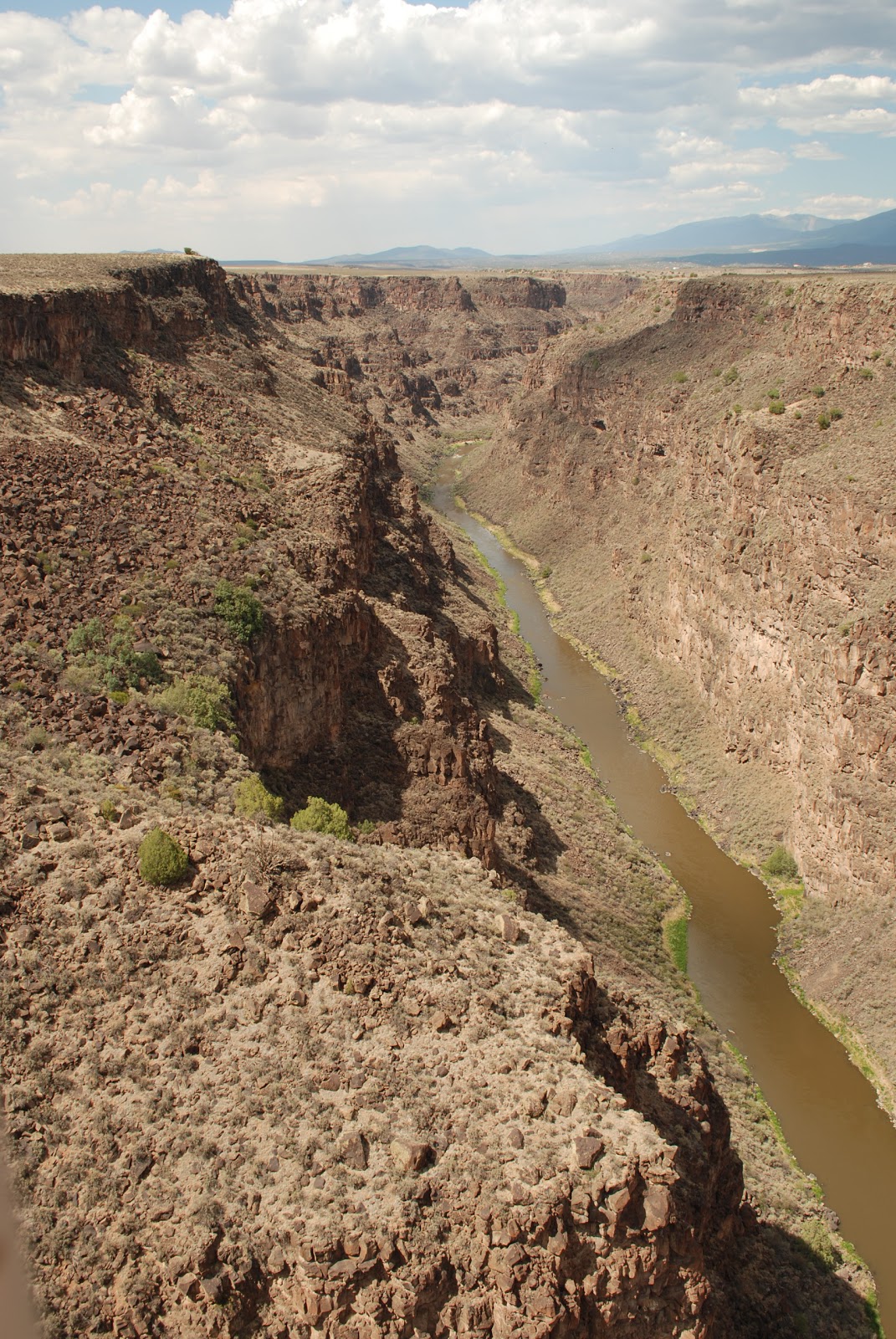
Not far from its birthplace in the San Juan mountains, the young Rio Grande descends into New Mexico just west of Ute Mountain. The river finds its way through the Taos Plateau. Eventually it will travel the entire length of the state dividing it in half. On the plateau the river finds a deep cleft left behind from tectonic shifts that occurred millions of years ago. This is the Rio Grande Gorge.
 |
| View of the Rio Grande from the Bridge |
The Gorge is the route of least resistance since it declines naturally into the valley below. Having escaped the dark and somber depths of the gorge, the river now begins its journey to the sea. The walls of the Gorge, made up of basalt, resemble a giant wound in the earth. Above it, the Taos Plateau extends for miles oblivious to the gash that splits it in two. The Rio Grande Gorge Bridge offers a grand view of the Gorge from 600 feet above the river.
 |
| The Gorge attracts many tourists |
Scientists have uncovered evidence that human life existed in or near the Gorge long ago. Perhaps these early inhabitants were part of the great civilizations that once lived in Mesa Verde and Chaco Canyon, two great cities that were mysteriously abandoned by the peoples who once thrived there. They left under mysterious circumstances long before the arrival of Europeans.
After passing through the Gorge, the river drifts lazily towards Santa Fe, the state capital. On its way it visits several towns along the Camino Real: Embudo, Velarde, Española, among others.
 |
Wineries abound along the Camino Real
This one is in Velarde |


Very Nice.
ReplyDeleteWhat did happen to those Civilizations?
I bet there are interesting Ruins to visit.
Do you think you could add a Map of the Rio Grande along with the Blog?
I have a general idea of where you are however having a Map handy might help us readers follow where you are.