Saturday, February 19, 2011

Ranching Then and Now

Private Chapel

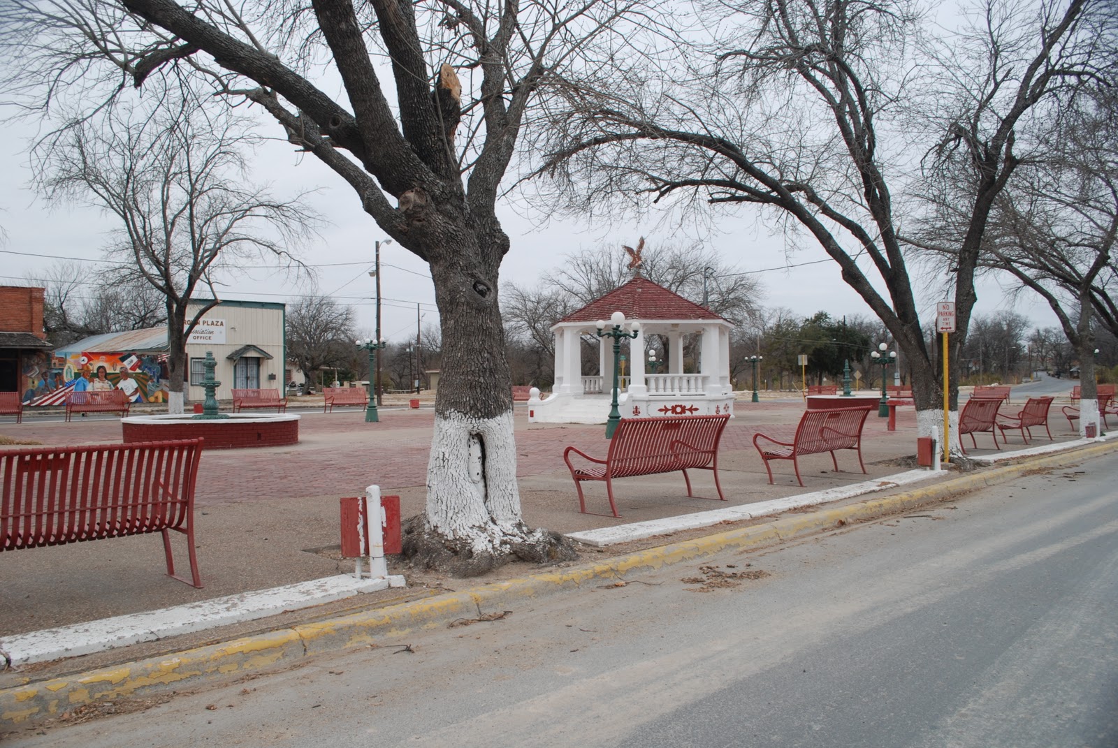
To most North Americans the Rio Grande in its southmost leg is the border between Mexico and the U.S. Most of us rarely consider the fact that long before it was an international border the river was a free-flowing stream running through the Spanish province of Nuevo Santander. In the agricultural community of Progreso, part of Hidalgo County, we learned about Toluca Ranch from an old friend, Dr. Blandina (Bambi) Cárdenas and her close friend, Rafael Flores, who introduced us to Patti Fernández Mayers and Imelda Guerra. The latter two are cousins descendants of the founding Spanish family that once owned the 10,000 acre Toluca Ranch. We spent the better part of the afternoon with Bambi, Patti, Imelda and Rafael listening to stories of the family's history in the area and gawking at the Italianate architecture of the chapel and ancestral home of the Fernández family. The property is registered in the National Register of Historic Places. 


It is unique in that it includes a private church built by the family and which is used today only for ceremonial occasions such as weddings, baptisms and funerals. It has no official connection to any denomination although the family is Catholic.

Fernández Family Home


The church and the home are both constructed of bricks made on the property using clay from the nearby banks of the Rio Grande. As late as the early 20th century marauding bandits attacked the home. Soldiers were brought in to help protect the family and several of them were killed in encounters with the bandits. Border violence, it seems, is not new to this area.

Today Rancho Toluca sits amidst fields of onions called "1015 onions " because they are usually planted around the middle of October. These are sweet onions that rival the better known Vidalia. They are said to make a delicious French onion soup. For those of you who may wish to visit Rancho Toluca the road leading to it is also known as Farm to Market Road Number 1015. Get it?

Toluca Ranch represents the early Spanish influence on ranching. Although the acreage was large there was no irrigation and raising cattle here was difficult since the flood water brush was thick and difficult to navigate many cows simply got lost and became wild. 

After the visit to Toluca Ranch our friends, Bambi and Rafael, treated us to a regional delicacy: cabrito al pastor or baby goat at El Pastor Restaurant in McAllen. Yet another wonderful meal on the Rio Grande.
We are thoroughly enjoying our venture along the Rio Grande including its regional cuisine. 


This section of the river is known as the Lower Rio Grande Valley. In reality, it is not a valley,  but a flood plain. We visited what was once a smaller ranch that had been settled by Nathaniel Jackson. He arrived here from Alabama around 1872. Although he owned a plantation and slaves he married Matilda Hicks, a black woman, and settled here with her. Together they gave shelter and food to other freed slaves.  
The First Spanish Language Methodist
Church in the Valley

The Jacksons bought 5,000 acres of land a small part of which they donated to construct a protestant church which was to become the first Spanish language Methodist church in the region. A small cemetery located next door to the church serves as the burial grounds for much of the Jackson family. 


Jackson Family Burial Ground

In contrast to the difficult ranching conditions of the 17th and 18th centuries carefully monitored by computers, nutritionists and veterinarians. J & R like other ranches of its type buys calves in the four to five hundred pound range then feed them carefully mixed grain and other products to double their weight. Many of the cows in these feed lots are owned by investors who pay J & R for fattening their calves. A given group of cattle reach optimum weight in about six months of carefully controlled feeding. At that point they are loaded on 18 wheeler trucks and delivered to the slaughter houses that buy them. State inspectors visit these lots on a regular basis to ensure that the conditions for feeding and treating the cattle meet state and federal standards.

Samantha Cortéz is a 5th generation
Tejana and heiress to the
J&R Ranch

Perch Pond at
J&R Ranch
Mare and her Filly
21st Century Ranching

Ranch Hand at work


Monday, February 14, 2011

Los Ebanos, Texas


Iglesia Católica
San Miguel Arcángel
Los Ebanos, Texas


We had heard conflicting stories about a small ferry on the Rio Grande. Some people said it had been washed away by the floods of 2010, others claimed it had been rescued. After twisting and turning throughout the town of Los Ebanos we came upon said ferry locally referred to as "El Chalán". Since we can do no better than this, we simply cite below the Texas historical marker that stands under an ebony tree between the river and the border crossing station.

Apparently this is an ancient ford. First recorded usage was by Spanish explorers and colonists under José de Escandón in the 1740's on the Rio Grande. A salt trail led from here to El Sal del Rey (40 miles northeast). The ford was used by Mexican War troops in 1846; by Texas Rangers chasing cattle rustlers, 1874; by smugglers in many eras, especially during the American prohibition years, 1920's and 30's. The ferry and inspection station were established in 1950. Named for the ebony trees here, this is known as the only government-licensed, hand-pulled ferry on any boundary of the United States.


On the way to "El Chalán"


We were charged $1.00 to walk to the water and photograph the ferry. Darn it! Will corporate America ever stop gouging us with outrageous prices.

The ferry officially known as "Los Ebanos International Ferry Crossing" charges $3.50 per vehicle w/ driver, and $.75 per passenger or pedestrian, children $.75.


Crossing over to the "foreign" side


On the way back on "El Chalán"
Safely back on US soil


On our way out of the parking lot we noticed a store front that we decided we should inspect further. We entered a cold, large room full of knick knacks, t-shirts, and other sundry items. We were followed by a gentleman who had been sitting in a car in front of the store. Since there was a bar, stools and what appeared to be packaged food we asked for a cup of coffee. They don't serve it; that's why he was warming up in the car. Mr. Jack Eberhart of Des Moines, Iowa a thin, wiry guy was an eager conversationalist with loads of stories of his travels in Mexico. In Texas he and thousands of others called Winter Texans or Snow Geese come South for the winter and return home in April after the snows have melted up North. Mr. Eberhart and his wife have traveled throughout the entire country of Mexico. He is a genuine "Mexicofile" who claims there are no friendlier people or more beautiful scenery than in Mexico. Jack claims he and his wife never had a bad experience of any kind while traveling in their pick-up truck throughout the country. He scoffs at the idea that Mexico is a dangerous country and is not traveling there now because Mrs. Eberhart is not well. He has accumulated 11 picture albums of the country during his nine years of travel. His wife says she has never felt safer than when she traveled in Mexico. 


"If I'm killed, I have nothing to worry about, if I'm robbed, I'll go the bank and get some more."
Jack Eberhart


Self explanatory

Tuesday, February 8, 2011

Internet down

Hi!

We've been unable to publish the last few days because of internet connectivity problems. We've got lots to tell you and will publish as soon as we can connect to the internet with some assurance.

Adíos, bye!

Sunday, February 6, 2011

San Ygnacio and Falcon Reservoir/Lake

Our hostess Doña Juanís


Mar y Tierra
Driving downstream from Laredo on US Hwy 83 we felt the need for a second cup of coffee by the time we reached San Ygnacio. We stopped at a wonderfully colorful restaurant, Mar y Tierra, mostly Tierra since we didn't see fish on the wall posted menu.  We were greeted by a warm and ebulient woman who insisted on feeding us. Mind you we'd already had a late breakfast at the Posada Inn in Laredo. Coni noticed, however, that there were 4 calendars among the many decorations hanging on the walls. The calendars brought to mind Blue Highways by William Least Heat-Moon, a book containing the exploits of a writer who traveled the secondary highways of the country. He concluded that the number of calendars provided by clients to the owners of restaurants were a direct testament to the quality of the food. Four calendars means the food must be given serious consideration. And, we proceeded to do just that.
Bean and noodle soup

Doña Juanís exclaimed that she had just put two fresh flour tortillas on the comal. She brought us two different kinds of soup; a wonderful noodle and bean soup and a regional variety of menudo or tripe soup. Thus fortified we set out to visit San Ygnacio.


Dating from approximately the same time as Laredo, San Ygnacio was never meant to become a city and it did not. It originated on the banks of the Rio Grande as the home of a ranching family in the mid 1700's. It is included in the National Register of Historic Places. In San Ygnacio we had the honor of meeting Sr. Uribe, a direct descendant of the founding family whose home literally sits on the banks of the river. Some of the buildings have been restored to give a wonderful sense of what these homes must have been like two hundred and fifty years ago. All were made of beautifully crafted stone. On some walls the builders left gun ports to protect agains attacks by the Lipan Apaches. This Native American tribe was particularly reticent to accept the European settlers.

Blending with nature
'69 Dodge
Back on Hwy 83 we drove towards Falcon Dam/Reservoir one of the largest bodies of water in the southern part of Texas. We stopped to ask for directions of a woman, Elvia Garza and her son, Miguel. While listening to their directions we noticed a beautiful '69 Dodge pick-up truck covered with ivy. After asking permission to photograph it the woman launched into explanations of the make and year of several old vehicles on the property. We spent a delightful time walking through thorny bushes to discover yet more old trucks and parts of others. One of those trucks was a Chevy Luv. Does anyone remember them?


Back on track again, we headed for our original destination of Falcon Lake. We came to the dam and rode half-way across it where the US and Mexican flags the water boundaries of the two countries.
Falcon Dam/Reservoir


Tomorrow we plan to visit two other old towns: Roma and Rio Grande City.

Friday, February 4, 2011

Laredo: A look back

This morning we met with Odilón Arámbula former editor of the Laredo Times. He regaled us with stories of Laredo's rich history. Thanks to him we walked away with a copy of Laredo A Pictorial History by Jerry Thompson. We also want to thank Alfredo De Los Santos, Jr for introducing us to Odie and for his moral support of this project. Alfredo has also made available part of his collection of books on border history.


The Spanish efforts in New Mexico were largely oriented towards finding gold and converting the Native Americans to Catholicism. Both endeavors were frustrating and yielded mixed results. In the mid-1700's the Spanish vice royalty in Mexico began moving in a different direction. Because they feared the intrusion of the French into what is now Texas the Spanish crown decided to establish towns and colonies along the lower half of the Rio Grande. This time their colonizing focused on stabilizing their control of the eastern portion of their empire.
Plaza San Agustín, the birthplace of Villa San Agustín de Laredo
still beautiful after 250 years
Villa San Agustín de Laredo was founded in 1755 by Don Tomás Sánchez a captain in the Spanish colonial army. It was one of the cities founded as part of the plan to defend against the French and establish trade opportunities from Mexico into this region. No town or city established at the time took the idea of trade and commerce more seriously than Laredo. From a modest beginning on the banks of the Rio Grande Laredo has grown to become the largest land port in the United States. It is a maze of express ways and rail lines that connect the two countries in the strong embrace of commerce.

Several times a day Laredoans face the aggravation of waiting
for international trains to cross the river


Interstate Highway 35 that runs through Laredo is the Pan American Highway. It connects the Dallas-Fort Worth area to every country in Central and South America. Hundreds of 18 wheelers thunder in and out of the US in a never ending stream. Some of these trucks carry imported goods from south of the border while others are merely bringing back the products of the hundreds of maquiladoras that line the Rio Grande on the Mexican side.


The contemporary emphasis on trade and commerce obscures other interesting aspects of Laredo's history. In the1840's for example, Laredo became the capitol of the Republic of the Rio Grande an abortive attempt to create a long and slender country that would straddle the Rio Grande and serve as a buffer between the US and Mexico. The Mexican military squashed the attempt. The Republic of the Rio Grande lasted less than one year. The head of its cavalry was beheaded and his head impaled and exhibited in his home town as a lesson to the citizenry. Most Texans have heard of the six flags that have flown over Texas. The flag of The Republic of the Rio Grande was actually the seventh flag.


During all of this period the Rio Grande was not a border between countries as it is today. As we drove along the river beneath the several bridges that link Laredo, Texas to its sister Nuevo Laredo in Mexico we were reminded of the counter-acting forces that create disunity today. In a stretch of river we found several Border Patrol officers parked along the causeway with engines running the temperature was about 30 degrees so it was unlikely that anyone would try to swim across, but the migra remained on the alert.


An interesting aspect of Laredo life today is the high degree to which its residents maintain a strong bilingual tradition and a facility to engage with each other on cultural affairs. Regrettably, recent episodes of criminal violence on the Mexican side of this community have cast a pall over these interactions.
Large flags wave at each other across the Rio Grande


General Ignacio Zaragoza, victor of the Battle of Puebla,
Cinco de Mayo. Stone sober...
In the past Larodoans thought nothing of walking or driving into their neighboring city for dinner or shopping. Those experiences have become fewer and fewer as North Americans withdraw from areas in which violence has been known to occur in the past. The economic impact of this estrangement is that Mexican businesses are suffering from the loss of clients and customers from the U.S. side.

Cinco de Mayo?


At the plaza de San Agustín the center of early Laredo life we ran into a monument to the Mexican General Ignacio Zaragosa. He also has a street named after him. General Zaragosa was the commander of the Mexican army who defeated the French army at the Battle of Puebla. Thus ending the reign of the Austrian Prince Maximillian who had been sent to Mexico by Napoleon. It seems he was the only young prince in Europe at the time who did not have his own country. That famous battle is celebrated today on the 5th of May. Many Americans believe this calls for celebrating with huge amounts of liquor and liquor merchants and distributors do not argue with this trend. There is no evidence that 
General Zaragosa celebrated in like manner; indeed 
he looks quite sober.

There are few flowers in a very cold February;
we could not miss this one!

Thursday, February 3, 2011

San Felipe Redux

Streetscape in San Felipe

Before moving on to Laredo and San Ygnacio two important sites on the river, we wanted to say a bit more about San Felipe Creek in Del Rio. This small waterway that empties into the Rio Grande was the primary reason Del Rio was sited here. Regrettably, it also served as the dividing line between rich and poor. While other cities may have the wrong side of the tracks Del Rio had the wrong side of the Creek and the effects of that separation are still visible. Particularly complicated was the creation of two separate school districts each serving only one side of the Creek's population. Crafty politicians managed to assign the children of the local air force base to the more prominent school district even though the base was closer to the San Felipe or poorer side of the Creek. This had the effect of syphoning federal funds that would otherwise go to the poorer district. After several decades of lobbying and political activity the situation was finally resolved by combining the two school districts into one. This solution ended the segregation of Mexican children but it also denied their community the ability to manage their own schools.
Plaza de Recreo in San Felipe

Beautiful church on the other side of the tracks err... I mean creek.

Wednesday, February 2, 2011

Del Rio, Texas

Arrived in Del Rio shortly after noon. We were anxious to see the waters of the Rio Grande as soon as we could. You might be able to tell by the picture that it is bitterly cold and the wind is creating white caps on Lake Amistad. The bridge in the background connects Del Rio to its sister city Acuña on the Mexican side of the lake.

The town of Del Rio grew up here along the banks of a beautiful, spring fed creek bearing the name of San Felipe.  Somewhat neglected today there are some efforts being made to maintain the creek in pristine condition even though it runs through the heart of the city.


When the town's people applied for their own post office the bureaucrats in Washinton, D.C. took the liberty of shortning the name from San Felipe Del Rio to just Del Rio. Hence, in translation, the town's name is now "of the river".  Apparently, there was another San Felipe in Texas at the time and the post office thought this would avoid confusion.

We're packing up now for a three-hour drive to Laredo the next big city along our route.

Tuesday, February 1, 2011

Day 2 - San Antonio to Del Rio

We arrived in San Antonio to a temperature of 80 degrees and awoke this morning to something in the upper 30's! They refer to these cold spells as being driven by a "blue norther". It's an apt name. All your extremeties turn blue!
We had breakfast at Mi Tierra (my dirt) in a historic area called Plaza del Zacate. This restaurant has been here for about 100 years and claims that its doors have never closed. It's a 24-7 operation dating from a time when this was a red light district catering to farmers who brought their products to the market.
Following breakfast our next stop was the Institute of Texan Cultures looking for possible reference material on the river. Zero, zilch, nada...
We're about to get in the car and head south to Del Rio. More from there later.