Tuesday, October 4, 2011

Birth of the Rio Grande


 San Juan Mountains
The Rio Grande's birthplace is in Southwest Colorado not far from the continental divide. The first waters come from three small streams at an altitude of some 12,000 feet above sea level in the San Juan mountains.

Two friends of the authors hiked up to this area in the late summer. The two retired professors, Alfredo de los Santos and Dick Richardson volunteered to bring us photographs of the headwaters region. We are indebted to them for the favor. As reported by these adventurers, and as it can easily be seen from their photos, the region is astoundingly beautiful.


Purple Mountains Majesty


Stream becoming river


Arguably, this is the most beautiful part of the river, the point at which you can still walk across it by stepping on river stones. Yes, these gentlemen saved us the trip but they got to see the great panorama and we did not! They also ate some fine trout they caught themselves. We commend them for being able to hike for two days for these privileges.

The photos brought back by our friends focused on the South Fork of the river, one of the three streams that come together to nudge the river down from the mountain, through the San Luis Valley and into New Mexico. 

Crossing the Rio Grande...legally!

Saturday, August 20, 2011

Rio Rancho is not a river...

The beauty of the forest survives the Las Conchas fire
Our visit to New Mexico took place during an extremely dry summer. In the Albuquerque area, the Rio Grande labors to enter the city. The river seems exhausted with a greatly reduced volume of water. It is hard to imagine the past grandeur of the river before the changing climate and heavy diversions of water reduced it to a mere stream. It is hard to believe that humans have been using water from this river for more than 12,000 years to sustain life. Pictograms and petroglyphs along its path attest to this. This year, due to the combined effects of limited snow melt in Colorado and little rain, the river is dry. At this point, only the Rio Chama has contributed tributary waters and no other river will do so until the Rio Grande reaches the Big Bend region of Texas. There the Rio Conchos will contribute a substantial amount of water from the mountains of northern Mexico. A trucker we spoke with said this is why farmers and ranchers on the lower Rio Grande pray for rain … in Mexico. Behind the scenes U.S. and Mexican officials debate how these new waters will be apportioned downstream. In recent years, these battles have involved the presidents of the two countries although they rarely come to the attention of the general public. In the future, climate change may make this the strongest source of friction between the U.S. and its neighbor.


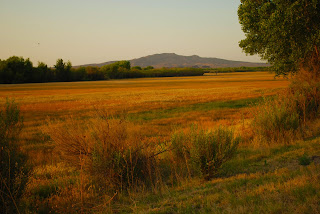
Parched landscape along Route 528
Coni took only a few images of a river struggling to survive under the broiling summer sun.We move on towards the Jémez mountains surrounding the city of Los Alamos. 


As we drive north and west of Albuquerque we skirt the usual array of bedroom communities that now surround many American cities. 
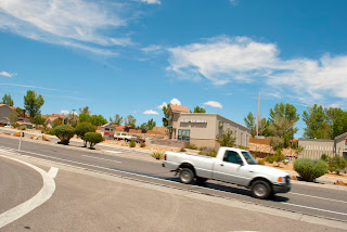
Suburban sprawl along Route 528 west of Albuquerque
Albuquerque is not immune to sprawl but we are not interested in shopping malls. Like the river itself, we move on. Our destination is Los Alamos on the western part of the state almost to the border with Arizona. 


Los Alamos, the bomb and a big fire


When we arrived in New Mexico several weeks ago the infamous Conchas wildfire had devastated northeastern Arizona. It had burned through the state border and headed toward Los Alamos. The city was evacuated but its residents had come back after the fire had been partially contained. Nonetheless, the absence of rain worried everyone in the area. As we drove in the direction of Los Alamos from Albuquerque, rain clouds began to gather for the third day in a row. This could be the day we have all hoped for. 


Route 4 Valle Grande, Valles Caldera
Past the Jémez Indian reservation the welcome rain began. It soothed the fire scarred forests. The cool breeze accompanying the rain brought out the aromas of the forest. The landscape was transformed from a parched forest to a cool alpine setting. During pauses in the rainstorm we enjoyed some of the most beautiful mountain vistas in the American Southwest, namely the Jemez mountains and most notably, the Bandolier National Monument.


Still standing
After the scenic drive through rainy mountain roads our arrival in Los Alamos was a bit anticlimactic. The city does not have the historical charm we had come to appreciate in Spanish colonial New Mexico. It is a modern, high altitude city with wide clean streets and all the conveniences of modern urban life. It is a city that would look fairly much the same if it were situated in the Northwest, Midwest or even in New England.


We can still find beauty among the ruins


Los Alamos' chief claim to fame is that it was the birthplace of the atomic bomb, an achievement that is not universally applauded as something deserving of civic pride. The truth, of course, is that few if any, residents of the city actually participated in creating the bomb. The team headed by Robert Oppenheimer was comprised mostly of European scientists who were brought there by President Truman. Nonetheless, the city proudly displays a sign at the edge of town claiming that this is the place “ where discoveries are made”. 


Awesome as the power of the atomic bomb may have been, we were much more impressed by the scenic beauty of the mountains that surround this city. This may qualify us as genuine tree huggers. So be it.


Rio Grande south of Los Alamos, New Mexico


Saturday, July 30, 2011

Bosque del Apache National Wildlife Refuge


The taming of free flowing rivers by means of dams and controlled releases of water becomes necessary when large numbers of people build homes and workplaces on the floodplains of such rivers. But the result of these large scale engineering projects can have negative as well as positive consequences. Problems often develop when one or more of the river's functions, such as scouring its own channel to make room for new vegetation, is prevented or impeded. 

Because much of New Mexico is arid or semi-arid, the state has had little choice but to manage its rivers closely. Since 1939, the state and U.S. governments have worked together to reduce the negative impact of these alterations on the Rio Grande to improve the riparian aspects of river life and preserve the river's ability to serve as a refuge for wildlife. 

Sunrise at El Bosque
The most ambitious and largest project of this type is the Bosque del Apache National Wildlife Refuge. A 90 square mile section of the Rio Grande south of the city of Socorro had once been a major wintering spot for large migratory birds. Because of water control measures upstream, its marshes had become silted over and thick brush covered much of the river's causeway. The area was in danger of becoming inhospitable to wintering birds for hundreds of years. The goal of the Bosque del Apache project is to gain control of all aspects of the environment through interventions that mimic those of nature. These efforts include cleaning the river's channels by removing plant life that is not native to the area, removing sand bars and other obstructions, and in every way making the marshes attractive to birds and animals. Part of the refuge has been set aside as farmland where grains of various types are cultivated to provide food for migratory birds.
Sites along the tour route

The results of this aggressive approach to park management have been striking. Where once migratory bird populations had dwindled to mere dozens of birds, today thousands of ducks, bald eagles, cranes and geese winter here. Throughout the winter months the park teems with birds and local animals. In short, an entire ecosystem has been rescued. Once they winter here for the first time the birds appear to look upon the human visitors as part of the environment.

Over the seventy years it has been in existence, the Bosque del Apache Wildlife Refuge has shown that people can be helpful to nature in maintaining the balance of complex systems. Riparian systems must accommodate the needs of resident wildlife as well as visiting birds. The needs of all species are similar. They include food, shelter, and security. They also include the need for continuity and pacing of life's various stages: mating, birthing and raising of the young. In all of these areas Bosque del Apache has succeeded in emulating a healthy ecosystem that now attracts more migratory birds than it did half a century ago. Our visit to this segment of the Rio Grande took place in July when there are few large birds in the refuge. Most have gone home and will not return until the winter. Nonetheless, a drive through the park was instructive.We look forward to a return visit in midwinter.


Sunday, July 17, 2011

Santa Fe, The City Different

The city of Santa Fe, literally Holy Faith, has served almost continuously as a state or territorial capital since the late sixteenth century. The modern Santa Fe was founded in 1608. The Spaniards used the existing Indian pueblo as the base on which to create the capital of their territory. (Twelve years later the English speaking immigrants landed on Plymouth Rock.) The Spaniards adopted native architecture and construction techniques. They borrowed the Native American adobe style enhancing it by adding windows, Spanish tiles, and iron fixtures.
Iron Fixtures...a ubiquitous feature
Santa Fe colors

Indian and Spanish Architecture
This city, the fourth largest in the state, may be the most charming of the country's state capitals. It takes little more than the mention of its name to bring a smile to persons who have been here before. The city has managed to maintain much of what has characterized it for centuries. Even the spaghetti bowl of its downtown streets has the charm of historical authenticity. Some of these streets have existed since pre-columbian times when today's plaza was the center of an Indian Pueblo.


A lovely afternoon for a walk on the plaza or a relaxing nap


Art flourishes in Santa Fe from the high culture of the Santa Fe Opera to the street vendors hawking silver jewelry around the plaza. Art galleries are numerous especially on the art strip known as Canyon Road. During the Christmas season the city is especially attractive. Hundreds of lights known as luminarias are placed atop many buildings. Some of these lights are made in the traditional way with a base of sand in a paper bag into which is placed a candle that burns into the early morning hours. Some commercial establishments have yielded to the efficiencies of modernity and adopted electric lights. 

Art in all its forms can be found in SF


Art, tourism and state government are the most important industries in Santa Fe. New Mexico has small population. It is no surprise therefore, that the administrative offices that manage its affairs are not large. Sixty miles south of Santa Fe is Albuquerque, the fast growing center of business and industry for the state. Recently, a light rail link has been created that puts that city along with its airport within easy reach of Santa Fe. It is not an over simplification to say that one city embraces the sciences while the other favors the arts.


Sidewalk vendor at the Plaza

But Santa Fe is embracing modernity as it comes into the 21st century. The tentacles of globalization have begun to reach into the city's arts world. An international celebration of folk art has attracted many visitors. This year, nearly one hundred countries were represented by artists and artisans from those countries. 

The Concho Fire darkens the otherwise beautiful sunset

Thursday, July 14, 2011

El Camino Real and its River

In the 16th century, how would you get from Mexico City to Santa Fe? Answer: Follow the Royal Road. The Spanish explorers and the priests and settlers who accompanied them faced the incredible challenge of walking or riding on horseback for hundreds of miles from Mexico City to Santa Fe in all kinds of weather. The soldiers wore protective armor made of steel and carried heavy weapons. The harshness of the journey can be felt today by hiking in any place in the southwestern deserts for a few hours.

A shady spot on the Camino Real near Abiquiú

To help future travelers manage the trek each caravan contributed a bit to improve the trail markers. Once little more than these random trail markers, much of the Camino Real (Royal Road) is now a paved road with occasional official markers pointing out the sites of important historical events.

As they saw the first Spanish caravans approaching on the horizon, the Native Americans who lived here could not have known the extent to which the newcomers would affect their lives and that of their descendants. The new arrivals built churches using Indian labor in near slavery conditions. Then they forced the locals to worship in them. They imposed Christianity on people who did not understand monotheism or the significance of the crosses atop every church building. No doubt many of the finer points of Christian theology were lost in translation. Neither could they understand the incessant barrage of questions regarding gold, the metal that preoccupied their visitors to the point of obsession.

From the start, the Royal Road hugs the Rio Grande almost continuously from the moment it leaves the mountain crossing at Paso del Norte, now shortened to El Paso. Except for the man made environment much of what we can see today along the Rio Grande was also seen by the Spanish who came here beginning in the late 16th century. It is noteworthy that, centuries later, old Spanish churches remain standing even though they were constructed of mud bricks baked in the sun. There are few credible statistics concerning the degree to which Catholicism has replaced any of the spiritual practices of the native inhabitants.

In the more rural communities the offspring of Spanish sheep, cattle, horses and chickens still roam throughout the region. Many Americans tend to forget that the cattle brought by the Spanish were the foundation of the cowboy culture that spread throughout the American Southwest. Today, only the larger city museums of Santa Fe and Albuquerque record this aspect of regional history. The same is true of the complex history of the relationship between European Americans and the Native Americans who were here long before.

Of a dark summer night, away from city lights and after most of the car traffic has diminished, some say they have seen strange figures trudging along the old Royal Road. For most visitors the road is now disguised by well paved roadways, and bridges that span deep ravines and whisk us to our destinations. 

Early summer evening on the Camino Real

Sunday, July 10, 2011

Abiquiú and the Chama River


Río Chama

The Rio Grande has a close cousin with a common birthplace in the San Juan mountains of Colorado: the Río Chama.  Although it is a short river only 135 miles in length, the Chama is vital to the ecosytem and to life on the Rio Grande because it functions as a collector of water from a number of streams and smaller rivers in the Tusas Mountains of northcentral New Mexico. Like the Rio Grande into which it empties, it helps to bring snow melt from The San Juan mountains to the fertile valleys through which it passes. But the Chama is not merely functional. In 1978, it was designated by the U.S. Congress as a “wild and scenic river” a designation that has helped protect the scenic beauty and clear waters of the region. 
Frank fishing for trout with his buddy on the Chama 
Tony will soon catch a beauty!

We met two fishing buddies Frank and Tony, retired policemen.


The Chama River Valley is located partially in Rio Arriba County. During the height of the Civil Rights movement in the 1960's, the town of Tierra Amarilla was the setting of a confrontation between residents of Río Arriba and the U.S government. A charismatic itinerant preacher, Reies López Tijerina, led a citizen revolt which made claims to the use of public lands dating back to the Spanish colonial period. The land in question was set aside for use as common grazing grounds without private ownership. After the war with Mexico, the U.S. government converted these ejidos into national forests and limited grazing, woodcutting and water use practices by the locals most of whom were small farmers. Tijerina sought to restore the ejidos to their original purpose but failed to do so through legal channels. He led an armed raid against the Rio Arriba Courthouse in Tierra Amarilla. Gunfire erupted with two government officers wounded. Tijerina fled into the mountains. Pursued by government troops who failed to apprehend him, Tijerina surfaced in Albuquerque where he surrendered to the authorities. He was released only on condition that he end his leadership of his insurgent group.  
Río Arriba Country Courthouse

Although he was supported by leaders of the Chicano movement of the 60s and 70s, the latter had different goals. Tijerina and his followers were chiefly Spanish Americans who did not identify culturally with the Mexican history of the area. They prefer the term “Spanish American" in recognition of their unique history. The ejidatarios who formed the bulk of Tijerina's followers trace their roots in the Chama Valley to Spanish settlers who arrived nearly 400 years ago.

Abiquiú

We drove to the Chama Valley on Route 84/285 from the town of Española. A highlight of our visit to North Central New Mexico was the town of Abiquiú. The town was once an Indian Pueblo (Ha'agizh in Navajo) where Spanish settlers built their city on the same site. The town resembles an idle movie set. Where once 2,000 residents enjoyed the beautiful views, now a mere 40 families reside. Abiquiú's unique setting has attracted film makers. Half a dozen movies and most recently an episode of Breaking Bad (http://www.aoltv.com/2010/05/30/breaking-bad-abiquiu-recap/) have been filmed here. 
Santo Tomas Apostol Church


An important resident who came to Abiquiú in 1949 from New York City was Georgia O'Keefe (1887-1986), one of the nation's most acclaimed painters. The beauty of this region was captured by O'Keefe in many of her paintings. As a result, Abiquiú and its neighboring towns have become a magnet for artists and art dealers.

Grounds of Santo Tomás Apostol Church


One of the few remaining vestiges of early European history was the original church at Abiquiú. Located high on a hill overlooking the valley below. With the exception of electric lights and telephones the town has made few concessions to modern life. It has no paved streets or fast food outlets. The town is situated on a spur of the Camino Real that connects the region to other Spanish settlements in California.
As luxurious as they get!
Nearly 400 year-old Abiquiú Mission
Abiquiú Mission


Its long history notwithstanding, the most important feature of the Chama Valley is its natural beauty. Located less than 100 miles from the state capital at Santa Fe, it was surprising to find this bucolic setting so close to the busy streets of Santa Fe.
Río Chama in all its glory!

Vista from NM Route 84


Saturday, July 9, 2011

Rio Grande Gorge

Not far from its birthplace in the San Juan mountains, the young Rio Grande descends into New Mexico just west of Ute Mountain. The river finds its way through the Taos Plateau. Eventually it will travel the entire length of the state dividing it in half. On the plateau the river finds a deep cleft left behind from tectonic shifts that occurred millions of years ago. This is the Rio Grande Gorge.

View of the Rio Grande from the Bridge
The Gorge is the route of least resistance since it declines naturally into the valley below. Having escaped the dark and somber depths of the gorge, the river now begins its journey to the sea. The walls of the Gorge, made up of basalt, resemble a giant wound in the earth. Above it, the Taos Plateau extends for miles oblivious to the gash that splits it in two. The Rio Grande Gorge Bridge offers a grand view of the Gorge from 600 feet above the river.

The Gorge attracts many tourists


Scientists have uncovered evidence that human life existed in or near the Gorge long ago. Perhaps these early inhabitants were part of the great civilizations that once lived in Mesa Verde and Chaco Canyon, two great cities that were mysteriously abandoned by the peoples who once thrived there. They left under mysterious circumstances long before the arrival of Europeans.


After passing through the Gorge, the river drifts lazily towards Santa Fe, the state capital. On its way it visits several towns along the Camino Real: Embudo, Velarde, Española,  among others.


Wineries abound along the Camino Real
This one is in Velarde

Thursday, July 7, 2011

Finally! We're back on the road…New Mexico and the Rio Grande

Our first foray to the lands bordering the Rio Grande was to a segment of the Texas-Mexico border. On that trip we traveled some 400 miles of the river's journey to the Gulf of Mexico. In our second outing we hope to travel some 500 miles. In this segment of the blog we will focus solely on the river's passage through the state of New Mexico, a state whose history has been shaped to a great extent by the River.

Our first stop in the New Mexico portion of our travels was Las Cruces, the state's second largest city. This is a city that owes much of its modern day growth, prosperity and character to the atomic bomb and the science related industries that grew up around it. Its location close to the White Sands Missile Range has brought many government jobs as well as the emergence of New Mexico State University. Alongside its modern identity Las Cruces remains one of the state's most important agricultural areas. More recently, it has become an attractive retirement area for people who appreciate its temperate climate.
Farming along the Rio Grande

Here, the river serves a long strip of farmlands that runs from Hatch on the north to near El Paso on the south. This is the home of the famous Hatch chilies that are a signature ingredient in New Mexico's cuisine.

The story of Las Cruces is closely linked to that of its older neighbor, the city of Mesilla. At the end of the Mexican American war in 1848, residents of the newly annexed territories were given the choice to remain in their towns and villages as citizens of the U.S. or to move south to Mexico. Early maps of the new border were in error; they placed the border too far north. Eager to avoid coming under U.S. domination, many residents of the region moved to Mesilla in the belief that this would give them independence. As map errors were corrected and the impact of the Gadsden Purchase was felt, it quickly became apparent that the Mesilla plateau and the town of Mesilla were indeed part of the United States. With a communal shrug the new citizens of the U.S. settled in to accept their new political status. Even today the streets and architecture of Mesilla evoke a different time in its history. Two years after its incorporation as a city, the flag of Mexico went down in the village plaza and the stars and stripes went up. Eventually the disappointed residents of the city adjusted to being part of the United States even though they had never chosen to do so.

The Roadrunner is the New Mexico State Bird. The Organ Mountain Range is barely visible in the background as a result of this summer's forest fires.


Tuesday, March 29, 2011

One Big Church

There will eventually be 3,000 worshipers here
A fascinating experience in our travels through the lower Rio Grande Valley of Texas was our visit to the Basilica of the Virgin of San Juan del Valle located in the town of San Juan. At mid century San Juan was one of the poorest towns in the Valley. It was inhabited chiefly by seasonal farm workers who went north to pick cotton and other crops during the summer and returned to their modest homes to await the next crop/climate cycle. Many migrant families still live in the area.


In October of 1970, a deranged pilot of a small plane crashed his plane into the local Catholic church destroying it. There were no fatalities other than the pilot even though the local parochial school was only yards away from the church and classes were in session. The episode was regarded by the local faithful as a miracle. With the guidance of church leaders they set about building a bigger and better church as befits the site of a miracle. The result was a large modernistic structure with capacity for 3,000 people.


The building itself is impressive and beautiful but the significance of the church to the parishioners is even more impressive. We were told by someone who works at the church that the church is filled to capacity seven times each Sunday in a variety of masses. Services are held in Spanish, English or bilingually. During the bilingual mass we attended there was no piano or organ music to be heard. Instead, a colorful mariachi band played religious songs some in English and some in Spanish. An African priest delivered the homily. It was the first time either of us had heard mariachi music sung in flawless English or an African priest tackle Spanish!


The Mariachi Mass begins


Nationwide, most Latinos are Catholic but we were awed by the significance of this unique church to the local people. We did not research statistics on church attendance but there is likely to be only a small number of churches in the U.S. that can draw over 20,000 faithful for regular Sunday worship. After all, this is not a tele-evangelist monument to modernity; it is fairly traditional in format. What is the source of that power to attract parishioners and what keeps it alive Sunday after Sunday year round? The question is even more significant when we consider that the Basilica is located only a few miles from the Texas-Mexico border. On any given day cartel related violence occurs nearby. The Basilica of the Virgin of San Juan appears to be an island of spiritual tranquility and joyous worship.
Prayer Requests for Service Men and Women


Picture gallery of service men and women on active duty


We posed our thoughts to Dr. Blandina Cardenas, past president of the local university, the University of Texas Pan American. Dr. Cardenas pointed to the strong spiritual roots among the poor of the region many of whom have immigrated recently. This group has not yet been pressured to change their religious practices in the direction of becoming more  "American" in tone or substance. The Virgin of San Juan, she noted came here with the immigrants from Central Mexico. It is part of the cultural roots of the people and is therefore very much a part of making the church relevant to their history. She also noted that the tradition of adding indigenous elements to the European Catholic church has been part of Mexican religious history since Spanish missionaries began to Christianize the indigenous peoples of Latin America.


Hundreds of votives left by families
Every time a family returns safely to the valley after working for several months in northern areas of the country, they  pray to the Virgin of San Juan del Valle--to their own intercessor--both to thank her for their safe return and to ask for another fruitful year next spring. 


Filling jugs with holy water at the entrance to the Basilica

Even after leaving the migrant stream because of better education and better jobs the tradition of worshipping at this Basilica remains alive. As the immigrant memory fades and gains are made towards the American dream of middleclassdom, worshipping at the Basilica moves  into the next generation of Valley Catholics. The roots of Iberian Catholicism are as firmly planted in the flood plain of the Rio Grande as they are one thousand miles away from their beginnings in New Mexico.